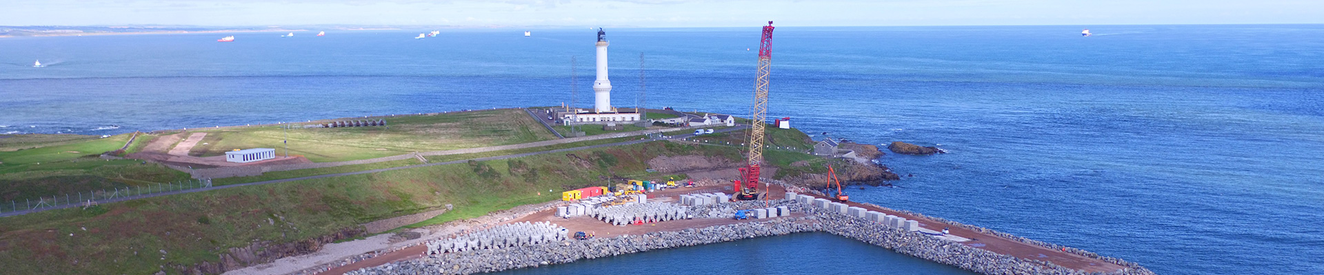
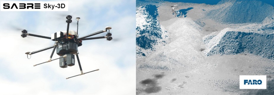
SABRE SKY-3D LiDAR Payload
The SABRE UAV LiDAR presently uses either any range of FARO Focus3D or SABRE S80 model laser with a single-beam which is accurately calibrated, delivering survey-grade results.
Airborne LiDAR systems offer rapid survey of areas within difficult, inaccessible or dangerous situations for ground-based survey.
Mounting of LiDAR systems on Drone Platforms provides enhanced results with the coverage being improved by the Line-Of-Sight. This is achieved by having a high-angled view-point from above reducing blind-spot areas when compared against the view-point seen from ground level using conventionally operated vehicle mounted LiDAR systems. The perspective of data acquisition at height also maximises the range capabilities of the utilised laser using a more ideal perpendicular angle of incidence encountered by the laser-beam.
The image above shows the detail captured using the SABRE Sky-3D S120 for quarry and stockpile assessment. The airborne UAV LiDAR captured point clouds show the enhanced coverage capabilities of scanning from a 30m flying altitude.
The SABRE S80 laser is a lighter-weight laser more suited to penetration of vegetation and forest canopy that produces ~58K Points per second.
Simple to operate, Portability and Security
All SABRE systems are designed with rapid deployment in mind and are sufficiently compact to be transportable for global operations. Systems have been developed from extensive LiDAR and laser System expertise as well as operational experience in the field. The UAV systems have been designed by our engineering team who stem from engineering and operations backgrounds.
SABRE ADVANCED 3D Providing Product Solutions to the Global market for surveying and inspectionOver four years of continuous development in laser, inertial measurement units IMU, GPS/GLONASS integration have been applied to produce the SABRE SKY-3D UAV LiDAR Remote Sensor Payload system. With battery weighing in at 5.4Kg for the SABRE Sky-3D S80 and 8.4kg for the SABRE SKY-3D F-3D the FARO Focus based solution. The system can be attached to most heavy lift UAV or Drone, VTOL, Multirotor, Helicopter and manned aircraft platforms on the market.
This system is suited for many applications where surveying with LiDAR and camera technologies are needed to produce high detail, accurate 3D models of terrain or structure.